


Survey Data
Reg No
11815020
Rating
Regional
Categories of Special Interest
Architectural, Historical, Social, Technical
Original Use
Bridge
In Use As
Bridge
Date
1830 - 1870
Coordinates
294174, 222959
Date Recorded
19/06/2002
Date Updated
--/--/--
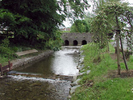
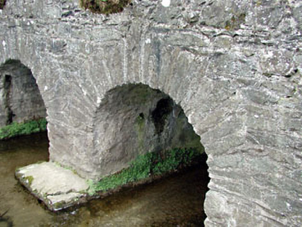
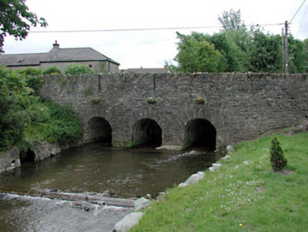
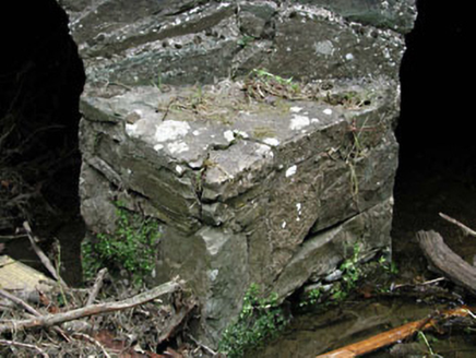
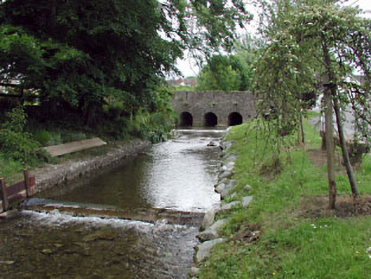
Description
Three-arch rubble stone road bridge over stream, c.1850, with triangular cut-waters to south-east, rubble stone voussoirs and parapet walls. Random rubble stone walls. Rubble stone triangular cut-waters to south-east. Rubble stone parapet walls with slit apertures and rubble stone coping. Three round arches. Rubble stone voussoirs. Rubble stone soffits with traces of render over. Sited spanning stream with grass banks to stream.
Appraisal
This bridge is a fine and stout rubble stone bridge that forms an imposing feature on the stream that passes through the heart of the village of Kill. The construction of the arches that have retained their original shape is of technical and engineering merit. The bridge exhibits good quality traditional stone masonry. The bridge is of considerable historical and social significance as a reminder of the road network development in Ireland in the mid nineteenth century.