Survey Data
Reg No
11816092
Rating
Regional
Categories of Special Interest
Architectural, Historical, Social
Original Use
Unknown
In Use As
Unknown
Date
1840 - 1860
Coordinates
262547, 210792
Date Recorded
28/05/2002
Date Updated
--/--/--
Description
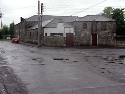
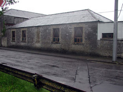
Attached five-bay double-height rubble stone building, c.1850, originally detached. Renovated and extended, c.1980, comprising single-bay double-height lower flat-roofed end bay to right (south-west) on a canted plan incorporating fabric of former boundary wall. Hipped roof with slate. Clay ridge tiles. No rainwater goods. Flat-roofed to additional bay behind parapet wall. Materials not visible. Random rubble stone walls. Section to centre rebuilt, c.1980, with yellow brick. Yellow brick course to eaves. Random rubble stone walls to part of additional bay (originally boundary wall). Rendered walls over. Painted. Cut-stone coping to parapet wall with cross finial. Square-headed openings. Replacement concrete sills, c.1980, to original block. Yellow brick block-and-start surrounds. Replacement timber casement windows, c.1980, with Gothic-style timber tracery. Timber panelled door, c.1980, to additional bay. Road fronted with additional bay forming corner. Concrete footpath to front.
Appraisal
This building, the original purpose of which is uncertain, is of social and historical interest, representing the continued industrialisation of Monasterevin in the mid nineteenth century, capitalising on the presence of the Grand Canal (Athy Branch) to north. The construction of the building in rubble stone with yellow brick dressings is representative of traditional building techniques and forms an attractive feature on the streetscape of Canal Harbour as it veers to meet with Drogheda Street to the south-east.


