


Survey Data
Reg No
13304001
Rating
Regional
Categories of Special Interest
Architectural, Social, Technical
Original Use
Mill (water)
In Use As
Outbuilding
Date
1780 - 1820
Coordinates
222588, 281164
Date Recorded
26/07/2005
Date Updated
--/--/--
Description
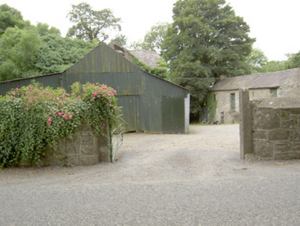
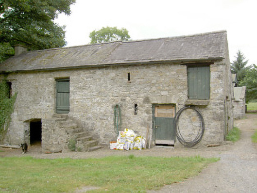
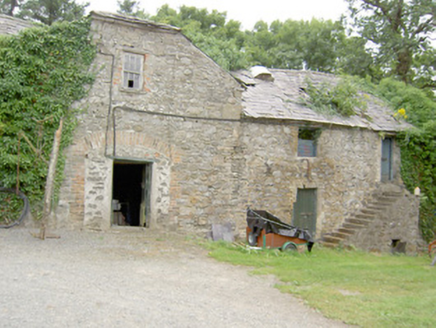
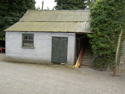
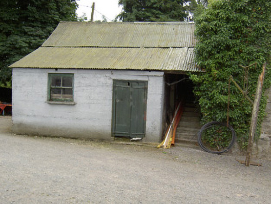
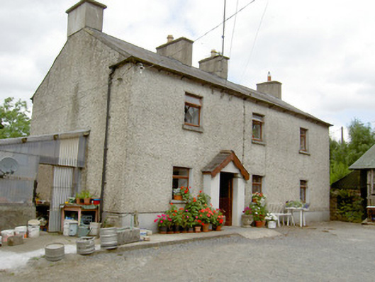
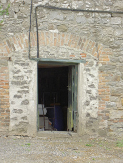
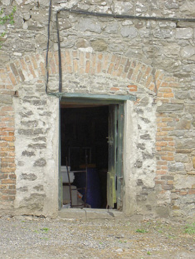
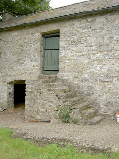
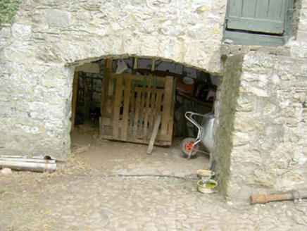
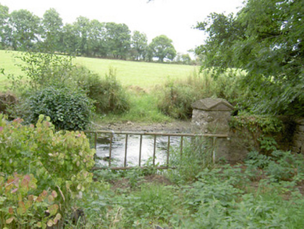
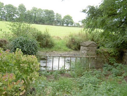
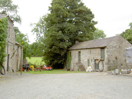
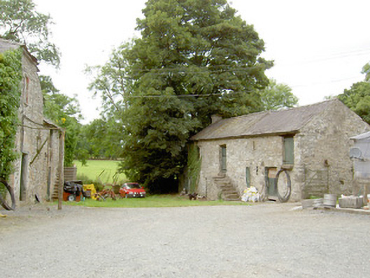
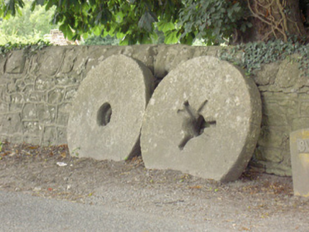
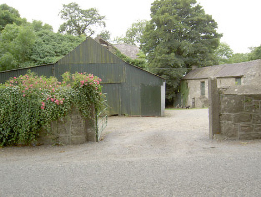
Former corn mill complex, built c. 1800 and extended c. 1860, comprising two multiple-bay two-storey rubble limestone mill buildings. Now in use as domestic outbuildings associated with former mill house (Mill Park House). Multiple-bay two-storey mill building to the north with pitched natural slate roof having a rendered chimneystack to the west gable end. Rubble limestone walls with square-headed window and door openings having timber battened doors and cut limestone voussoirs. Flight of stone steps to centre to main elevation (south). Segmental-headed carriage arch opening to north of steps having cobbled floor to interior and exterior. Multiple-bay two-storey mill building to south of complex, built c. 1800 and altered c. 1860, having gabled bay to the center of the north elevation and rubble limestone exterior steps to the west end of north elevation. Pitched natural slate roof with half-hipped natural slate roof to projecting bay. Rubble limestone walls with square-headed openings having red brick surrounds and timber doors. Square-headed window opening to projecting bay at first floor level with six-over-six pane timber sliding sash window, limestone sill and red brick surround. Former segmental-arched opening to projecting bay at ground floor level, now partially infilled and having square-headed door opening, with red brick voussoirs and surround. Outbuilding to site with pitched corrugated-metal roof, painted rendered walls, square-headed opening with two-over-two pane timber sliding sash window and square-headed opening with timber battened double doors. Detached four-bay two-storey former miller's house to east of site, with gable-fronted porch to front elevation, glass house to southwest elevation and single-bay two-storey return to rear (north). Now in use as private house. Pitched slate roof with rendered chimneystacks. Decorative timber bargeboard to porch. Roughcast rendered walls with smooth render plinth course. Square-headed openings with limestone sills and replacement timber windows. Square-headed opening with timber battened half-door. Set back from road in own grounds to the north of Ballinalee. Rubble limestone boundary walls to road-frontage having cut limestone gate posts to entrance. Rubble limestone walls to river bank (west) with rubble limestone piers having carved limestone cap. Mill stones to site. Former mill pond across road to the east. Millrace ran across south of site from east to west, no longer extant.
Appraisal
This picturesque former corn mill complex retains its early form and character despite being out of use for a considerable period of time. It was used for grinding oats and meal until the mid-twentieth century. The rubble limestone construction and the irregular spacing of the openings give these structures a distinctly vernacular appearance. The buildings retain interesting features such as the slate roofs, timber doors, flights of stone steps and timber sliding sash windows. It was probably originally built during the late-eighteenth or early-nineteenth century, a period that saw a great boom in the Irish corn milling industry. The former mill house (not in record), the simple boundary walls with cut limestone gate posts, the mill stones and the remains of the original mill pond to the east add to the setting and complete this composition. Although this complex is now derelict, it remains an important physical reminder of past industrial processes and represents an integral element of the industrial and economic history of the area. The former millrace, now no longer extant, ran to the south of the complex in an east to west direction from the mill pond to the Camlin River. A corn kiln is marked to the south of the millrace on Ordnance Survey first edition six-inch map of the site (1838). This mill was in the ownership of a William Foster c. 1854 (Valuation Office Mill Books). The complex consisted of a house, mill, offices and had a 12 foot water wheel at this time. The holding was 80 acres in size. The mill stones were reputedly taken from a mill in County Mayo.