


Survey Data
Reg No
13401803
Rating
Regional
Categories of Special Interest
Architectural, Artistic, Social
Original Use
House
Date
1810 - 1840
Coordinates
211822, 270996
Date Recorded
30/08/2005
Date Updated
--/--/--
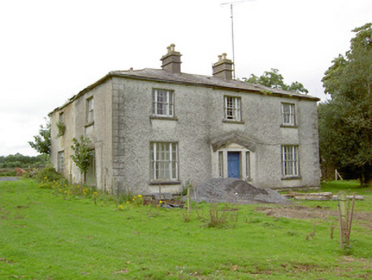
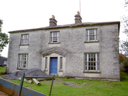
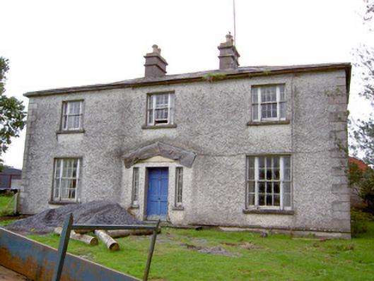
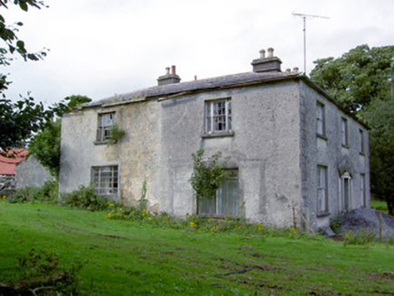
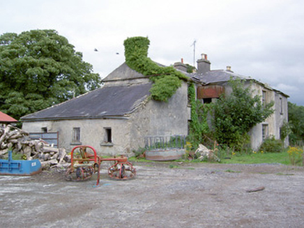
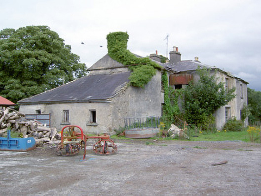
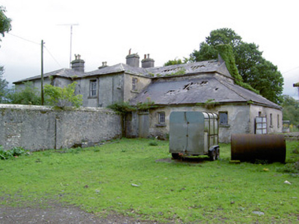
Description
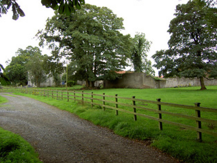
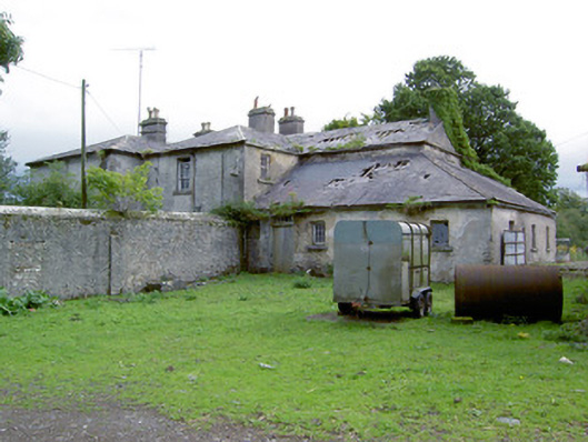
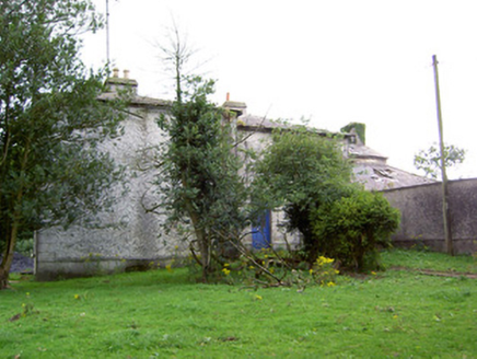
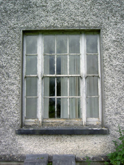
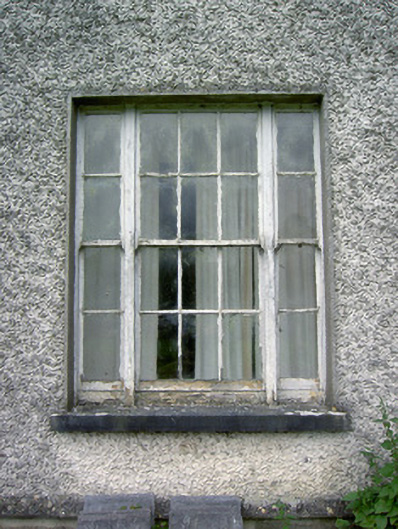
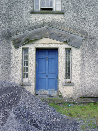
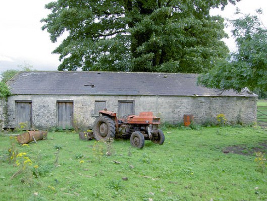
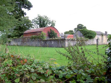
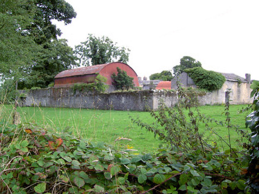
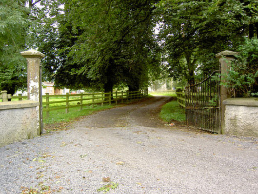
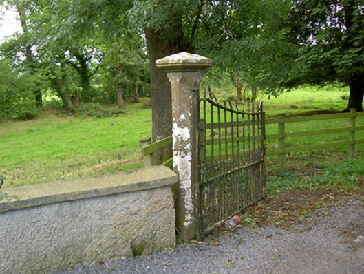
Detached three-bay two-storey house, built c. 1830 and altered c. 1865, on irregular plan having single- and two-storey blocks to rear (west), possibly incorporating fabric of earlier building(s). Wrought-iron tank to rear (west) to re-entrant corner (south side) of return. Now disused. Shallow hipped natural slate roof with a central pair of rendered chimneystacks to front block (east), having terracotta chimney pots over, and cast-iron rainwater goods. Two-storey block to rear with pitched slate roof having rendered rubble stone chimneystack to gable end to west. Pebbledashed walls over smooth render plinth course with render quoins to the corners. Lime roughcast rendered finish to single- and two-storey blocks to rear, now partially failing exposing rubble stone construction. Square-headed diminishing window openings to front elevation of front block (east) with tooled cut limestone sills and tripartite timber sliding sash windows comprising six-over-six panes flanking by two-over-two panes. Central square-headed door opening to main elevation (east) having timber panelled door flanked by fixed timber framed sidelights. Moulded cut stone step to front. Doorway formerly had pedimented Ionic doorcase, now removed. Set back from road in mature grounds to the east of Killashee and to the southwest of Longford Town. Complex of single- and two-storey outbuildings to the rear, built c. 1860. Two-storey multiple-bay outbuilding to the southwest having pitched natural slate roof, roughcast rendered rubble stone walls, and with loop hole and square-headed openings. Single-storey outbuilding to the northwest having pitched natural slate roof, partially roughcast rendered rubble stone walls, and square-headed openings, now blocked. Rendered rubble stone boundary walls and walls dividing yard to site, crenellated coping over boundary wall to the west. Modern farm buildings to the west side of yard. Main entrance gates to north of house comprising a pair of moulded sandstone gate posts having chamfered edges and moulded pyramidal heads, and with wrought-iron gates. Rendered walls to either side of main gateway.
Appraisal
Although now out of use, this substantial and well-proportioned house retains its early form and character. It also retains much of its early fabric including Wyatt style timber sliding sash windows. The tripartite Wyatt windows, the proportions to the front elevation and the shallow hipped roof to the main block lend this building a Regency period appearance, and suggests that it dates to the first decades of the nineteenth century. The main doorway formerly had a pedimented Ionic doorcase, the shadow of which can be seen surrounding the doorway. The complex form of this house to the rear suggests that it might contain earlier fabric, and that a new block was added to the front, c. 1820. It was enlarged c. 1865 (Ordnance Survey map information, and genealogical information: see below), and the outbuildings date to this period. The attractive and well-carved sandstone gates posts, and the simple wrought-iron gates, to the main gateway to the north form a suitably impressive entrance to this site. The modestly detailed outbuildings to the rear complete the setting of this composition, which is an integral element of the built heritage of the local area. The location of this building adjacent to St. Catherine’s Church of Ireland church (13401802) hints that it may have been originally built as a rectory. However, it is not indicated as a rectory on any maps of the area. There are references to a Rev. Francis Gregg, rector of Ballymacormick from 1842 - 1867, who lived at ‘the parsonage, close by the church of Ballymacormick’, so it is very possibly that this was originally built as a rectory. The Rev. Gregg (also of Oldtown House (13401451), near Ardagh) later moved to the rectory at Keenagh in 1867. The house was later renamed ‘Danesfort’ and was in the ownership of a Randal(l) Adams (1825 – 1913) during the late-nineteenth century (Slater’s Directories). Randal Adams previously lived at Rhynmount House (now demolished), to the south of Cloondara, until 1864. In 1864 Adams advertised an auction of the furniture of Rhynmount House as he was moving to a new residence (Longford Journal). This would roughly tie in with the dates of the move of Rev. Gregg (possibly) from this house. It is possible that the house was remodelled and the outbuildings built, c. 1865, just in advance of the move of Randal Adams. Adams was a important figure in the local area and served as a Grand Juror for Longford in the 1870s. He owned acres in the area, c. 1875, and is buried next door at St. Catherine’s Church (grave marker). Danesfort was later in the ownership of the Daly family c. 1915 (a Mrs Daly of Danesfort, Longford sold a number of household pets the proceeds of which she gave to the Prince of Wales Fund in aid of the soldiers’ and sailors’ families who were engaged in the war (World War 1).