
Survey Data
Reg No
14308019
Rating
Regional
Categories of Special Interest
Archaeological, Architectural, Technical
Original Use
Bridge
In Use As
Bridge
Date
1700 - 1740
Coordinates
275382, 280465
Date Recorded
23/05/2002
Date Updated
--/--/--
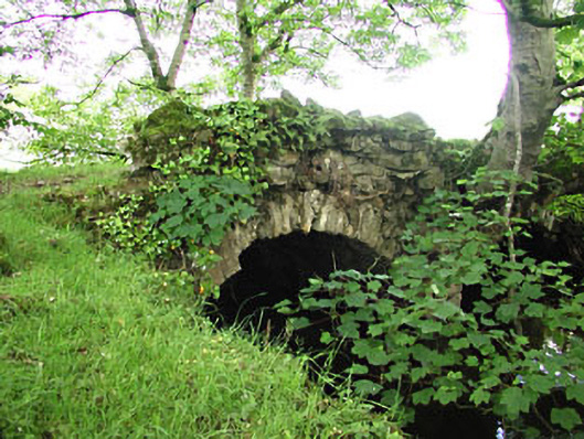
Description
Double-arch road bridge over river, built c.1720. Rubble stone walls with remains of some ashlar voussoirs. Remains of a rubble limestone parapet wall to the east side.
Appraisal
This bridge is unusual as the road sits directly on the arch below without a surface layer. The bridge is located at the end of the original lane from Newtown House to the bridge at Mahonstown. It forms part of a group with the related structures in the demesne. It may contain material of a pre-1700 date.