Survey Data
Reg No
16401301
Rating
Regional
Categories of Special Interest
Architectural
Original Use
Farmyard complex
Date
1740 - 1760
Coordinates
330736, 209247
Date Recorded
14/08/2003
Date Updated
--/--/--
Description
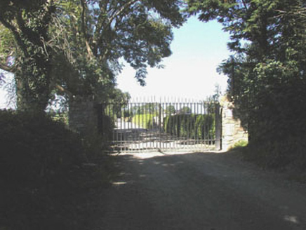
Remains of detached fifteen-bay two-storey rubble stone range, c.1750, possibly originally built as five three-bay two-storey units with single-bay double-height lower return (engine house?) to rear. Now in ruins. Pitched slate roof now gone with no rainwater goods surviving on squared rubble stone stepped eaves. Random rubble stone walls with remains of render over and red brick dressings including quoins to corners. Square-headed window openings with cut-stone sills, red brick block-and-start surrounds (originally concealed), and fittings now missing. Series of five round-headed door openings with rendered and cut-stone surrounds, and fittings now missing. Set back from road in unkempt grounds. Gateway, c.1750, to site comprising pair of granite ashlar piers with cut-granite capping, wrought iron double gates, and rendered curved flanking walls incorporating square-headed pedestrian gateways.
Appraisal
Although now in ruins, these structures survive as a reminder of a once-extensive agricultural complex that traditionally supported much of the local economy. The form and massing of the primary range survive, giving some indication of the original appearance of the building.

