Survey Data
Reg No
20903402
Rating
Regional
Categories of Special Interest
Archaeological, Architectural, Technical
Original Use
Bridge
In Use As
Bridge
Date
1630 - 1800
Coordinates
169069, 100471
Date Recorded
30/10/2006
Date Updated
--/--/--
Description
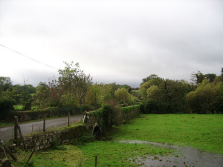
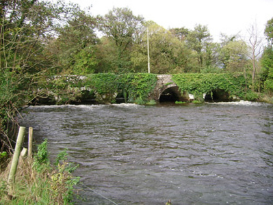
Six-arch rubble stone bridge carrying road over Awbeg River, built c. 1650, widened to north-west, upstream elevation c. 1780. Round walls and arches, with long rubble voussoirs to south-east elevation and roughly dressed voussoirs and V-cutwaters to north-west elevation. Causeway road with three round-headed arches approaches bridge from north-east crossing flood plain. Stone platform for water pump to south-west.
Appraisal
A simple, solidly built road bridge spanning the river Awbeg for over three centuries. It is an interesting record of bridge construction from the seventeenth and eighteenth centuries, when the bridge was widened to accommodate increasing traffic. The six round arches cross the river rhythmically and the rough limestone voussoirs make an interesting textural feature. The causeway approach road with its round arches is an integral part of the bridge.


