Survey Data
Reg No
30411208
Rating
Regional
Categories of Special Interest
Architectural, Social, Technical
Original Use
Mill (tide)
Date
1780 - 1820
Coordinates
134023, 213019
Date Recorded
16/08/2009
Date Updated
--/--/--
Description
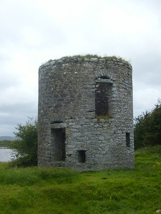
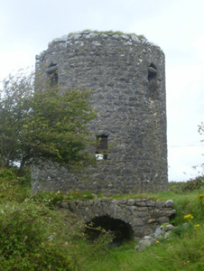
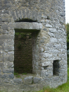
Freestanding circular-plan split-level mill building, built c.1800, now derelict. Rubble limestone walls having squared limestone capping. Segmental-headed culvert to basement level at south-west, with rubble limestone voussoirs. Round-headed doorway to basement level at west, having rubble limestone voussoirs. Square-headed window openings at various levels. Square-headed doorway to ground floor of east elevation and first floor at south-west, with limestone lintels and with rubble relieving arches overhead. Remains of central drain to base of interior, leading to culvert.
Appraisal
Although now roofless and derelict, this former tidal mill is an important part of the industrial heritage of the area - its operating mechanism confirmed by the culvert opening which would have allowed water to enter at high tide. This is quite an imposing strucure, which makes a strong contribution to the landscape. It is one of a group of tidal mills in the area. Interestingly, it is marked on the Ordnance Survey map as a windmill, rather than a tidal mill, so it may have used both sources of energy.


