Survey Data
Reg No
31308714
Rating
Regional
Categories of Special Interest
Architectural, Scientific, Technical
Original Use
Bridge
In Use As
Bridge
Date
1800 - 1838
Coordinates
97107, 281736
Date Recorded
20/12/2010
Date Updated
--/--/--
Description
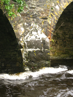
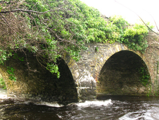
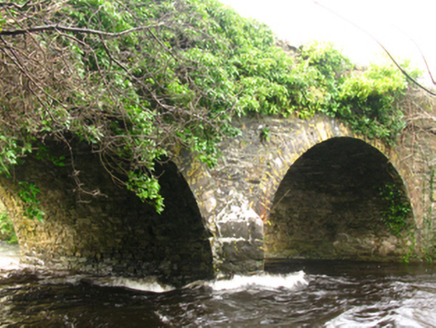
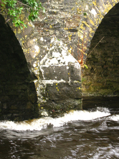
Two-arch road bridge over river, extant 1838. Part creeper- or ivy-covered coursed rubble limestone walls centred on limestone ashlar triangular cutwater to pier to upriver (east) elevation having lichen-covered pyramidal capping with overgrown coping to parapets. Pair of round arches with lichen-covered limestone ashlar voussoirs. Sited spanning Owenwee River with unkempt banks to river.
Appraisal
A bridge representing an integral component of the early nineteenth-century civil engineering heritage of County Mayo with the architectural value of the composition suggested not only by the traditional construction in unrefined local fieldstone offset by sheer limestone dressings demonstrating good quality workmanship, but also by the elegant "sweep" of the arches making a pleasing visual statement at a crossing over the Owenwee River: meanwhile, a discreet benchmark remains of additional interest for the connections with cartography and the preparation of maps by the Ordnance Survey (established 1824).