Survey Data
Reg No
40832001
Rating
Regional
Categories of Special Interest
Archaeological, Architectural, Historical
Original Use
Country house
In Use As
Country house
Date
1800 - 1810
Coordinates
221167, 401064
Date Recorded
17/10/2007
Date Updated
--/--/--
Description
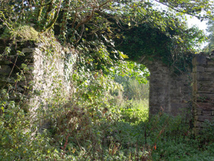
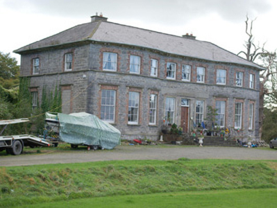
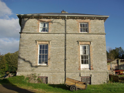
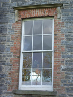
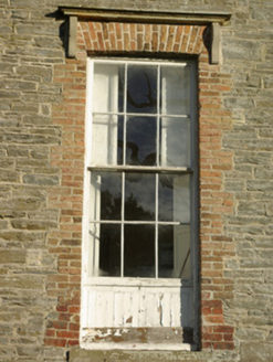
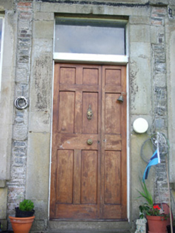
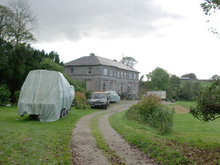
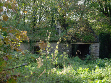
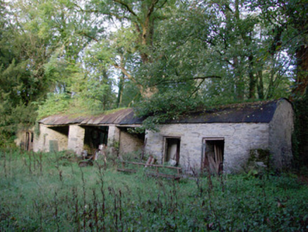
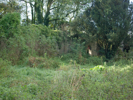
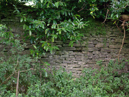
Detached nine-bay two-storey over basement (to rear) county house, built c. 1806-7, having full-height three-bay shallow bowed projections to either end of the main elevation (west) and with remains of single-bay single-storey structure to the centre of the rear elevation (west). Damaged by fire to interior in 1971 and re-roofed c. 1990. Hipped slate roof (added c. 1990), having central valley, wide overhanging eaves with projecting sandstone eaves course with paired cut stone brackets/modillions, some surviving sections of cast-iron rainwater goods, and with two rendered chimneystacks. Curved sections of roof over shallow bowed projections to front elevation. Irregularly coursed and squared rubble stone walls with flush quoins to the corners; projecting cut stone stringcourse/plinth course at ground floor level. Square-headed window openings with flush red brick block-and-start surrounds, cut stone sills, and with six-over-six pane timber sliding sash windows at ground floor level and three-over-three pane timber sliding sash windows at first floor level. Continuous cut stone sill course to main elevation at first floor level and cut stone entablatures supported on cut stone console brackets to ground floor window openings. Square-headed window openings to rear elevation with timber sliding sash windows; square-headed window openings to rear and side elevations at basement level having rubble stone voussoirs over and with wrought-iron security bars. Central square-headed doorway to main elevation having plain ashlar surround, replacement timber door, plain overlight; square-headed window openings to either side of doorway having plain cut stone surrounds and timber sliding sash windows. Doorway reached up flight of cut stone steps giving access to raised cut stone platform; steps and platform flanked by wrought-iron railings. Set well back from road in extensive mature wooded and parkland grounds a short distance to the west/south-west of Convoy. Deale River flows west to east to the south of the house and demesne. Main entrance gates with castellated gateway and lodge (see 40832003) to the north at start of long approach avenue to house. Remains of extensive complex of single- and two-storey outbuildings to the rear (east) and to the north-east having rubble stone walls, pitched and barrel-shaped slate and corrugated-metal roofs, and square-headed openings. Remains of former horse-powered churning mill to one of the outbuildings. Possible former chapel to the east, now ruinous. Walled garden (on rectangular-plan with bowed wall to the north) to the east having rubble stone boundary walls and integral round-headed doorways with roughly dressed voussoirs and surrounds, remains of rubble stone outbuildings/former greenhouses to the interior of walled garden. Possible remains of former icehouse to the north (not viewed). Site of former house to the north-east.
Appraisal
This impressive country house, of early nineteenth century date, retains its early form and character despite some alterations. Its well-proportioned and symmetrical front elevation is distinguished by the subtle and elegant full-height shallow segmental bows to either end, which helps create a distinctive building with a strong architectural character. The plain front elevation is enlivened by the understated cut stone plinth course and the sill course at first floor level, while the delicate cut stone entablatures over the ground floor window openings, and the simple but well-crafted cut stone surrounds to the doorway and sidelights, adds further subtle decorative interest. The wide overhanging eaves with a pronounced cut sandstone eaves course having paired cut stone modillions adds further to the imposing character of this appealing building. Although possibly originally rendered, the contrast between the grey rubble stone masonry and the red brick block-and-start surrounds to the window openings helps to create a pleasant tonal and textural variation to the main elevations. Although some of the fabric to the openings has been replaced, the modern fittings are in keeping with the style and character of the early fittings. The house was substantially damaged by fire in 1971, particularly to the interior, but much work has been carried out since to return the house to its early glory. This house was built and possibly designed by a George Taylor for the then owner of the estate, Robert Montgomery (1778-1846), while an Alexander Dick was employed as a stonecutter on the project (IAA). Based on cartographic sources, it is possible that the house was extended sometime between 1836 and c. 1860 (Ordnance Survey first edition six-inch map of 1836 where Convoy House is depicted as a building on a narrower plan with a central projection to the front elevation; Griffith’s Valuation map of c. 1860. Possible that projection to the front is the flight of steps). The present building replaced an earlier house or houses (RMP DG069-017---), on or close to the site (probably to the north-east of house) of the present edifice that, reputedly, dated back to the seventeenth century. The possible foundations of the earlier house are to be found to the north-east of the house, adding archaeological merit to this site. This house was purchased from the Nesbitt family by Alexander Montgomery (1686-1729) by 1720, although the Montgomery family was living in the Convoy area by 1684 when a Hugh Montgomery of Convoy is noted. Alexander was a noteworthy figure who served in the Scots Greys cavalry and as an MP for Donegal Borough from 1725 until his death. The Montgomery family was highly distinguished with a number of notable members, particularly in the military arena, including Major-General Richard Montgomery (1738-1775), who led the failed attempted invasion of Canada by the Continental Army during the American Revolutionary War in 1775; Colonel Alexander John Montgomery (1720-1800), who served in the British Army in Canada during the Seven Years War, served as MP for Donegal from 1768 until his death, and 1768 and was High Sheriff of County Donegal in 1773; while Field Marshal Bernard Montgomery, 1st Viscount Montgomery of Alamein, was a descendant of a branch of the family based at Moville. Convoy House was the home of a Revd. Charles Boyton during the late 1840s (married a daughter of Robert Montgomery). It was later the residence of Colonel Robert George Montgomery in the 1870s, 80s and 90s (Slater’s Directory of 1881 and 1894), who owned 8,861 acres in the area in 1876. This fine house, set in substantial and attractive wooded parkland grounds is an important element of the built heritage of the local area. It forms a pair of related structures along with the interesting castellated gateway (see 40832003) to the north. The substantial but now sadly ruinous complex of single- and two-storey outbuildings to the rear, some of which may have been originally associated with the earlier house(s) to site, and the substantial former walled garden to the east add substantially to the setting and provide an interesting historical insight into the substantial resources required to run and maintain a large country estate in Ireland during the nineteenth century, and perhaps earlier. One of the outbuildings to the rear retains the remains of a former horse-powered churning mill, now a rare survival that adds further interest to this site.
