Survey Data
Reg No
40838022
Rating
Regional
Categories of Special Interest
Architectural, Technical
Original Use
Bridge
In Use As
Bridge
Date
1770 - 1860
Coordinates
214447, 394836
Date Recorded
04/02/2008
Date Updated
--/--/--
Description
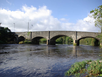
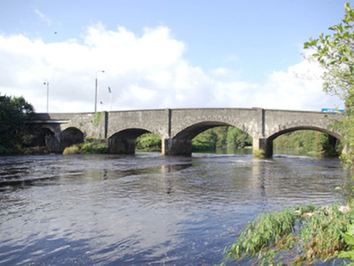
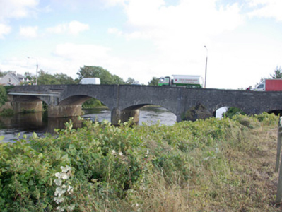
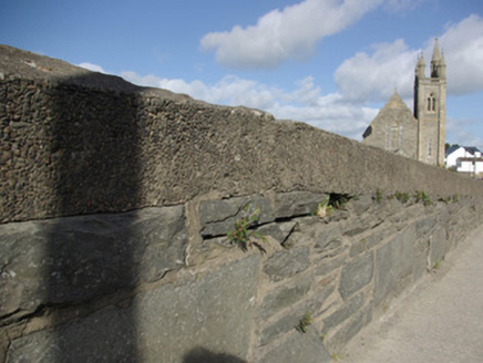
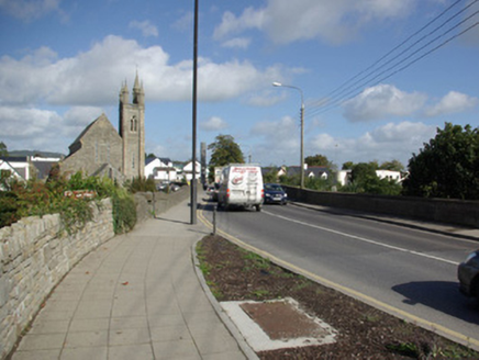
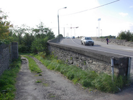
Five-arch bridge carrying road over the River Finn, built c. 1780 and extended to the west\south-west end c. 1860, having V-profile ashlar cutwaters to piers to the west end (original bridge of three arches) rising to rubble stone piers (on square-plan) over. Segmental-headed arches to the original bridge having ashlar or render block-and-start voussoirs, squared rubble stone construction to piers, cement rendered lining to arch barrels. Segmental-headed arches to later section to the west\south-west having render block-and-start voussoirs, cement rendered lining to arch barrels, and rubble stone construction to piers. Roughly squared and coursed rubble stone construction to spandrels, abutments and parapets with modern render coping over parapets. Steel I-beam supports to west end of bridge; rubble stone wing walls to either side. Tarmacadam deck with footpaths to either side. Laneway to the south-east corner of bridge, giving access to river, having rubble stone wall to the south. Located in the streetscape to the east of Ballybofey and to the west end of Stranorlar.
Appraisal
This impressive and elegant bridge retains its early character and form, and is an appealing feature in the streetscape dividing the towns of Ballybofey to the west and Stranorlar to the west. It is robustly-constructed in good quality squared local rubble stone masonry, and its continued survival and use stands as testament to the quality of its original construction, and of the skill of the masons involved. The V-shaped ashlar cutwaters demonstrate a sophisticated level of design and engineering and are clearly the work of skilled masons. This bridge probably originally dates to the late-eighteenth century, a period that saw a great deal of road and bridge-building in Ireland, particularly by the Grand Juries (the forerunners of the County Councils) - a bridge is depicted here on the Taylor and Skinner map of the area from 1777 – 1883. It is possible that its construction was funded or partially funded by the Hayes and\or Basil families, of nearby Drumboe Castle (now largely demolished) to the north-west or, perhaps, by the Marquis of Conyngham, the proprietor of the town of Stranorlar during the late-eighteenth and the early-nineteenth century. It was originally a slightly humpbacked triple arch bridge but it was widened to the west side by two arches sometime during the second half of the nineteenth century, possibly as part of drainage works on the River Finn c. 1860 or, perhaps, around the same time that s narrow gauge railway bridge (now demolished) was built adjacent to the south c. 1894. This bridge probably replaced an earlier bridge over the River Finn at Stranorlar, which is depicted on Molls map of Ireland dated 1714. This bridge is an important element of the built heritage of the local area, and is a feature of some picturesque merit over the River Finn dividing the so-called ‘twin towns’ of Ballybofey and Stranorlar.
