


Survey Data
Reg No
40852077
Rating
Regional
Categories of Special Interest
Architectural, Historical
Previous Name
Ballyshannon Horse Barracks
Original Use
Barracks
Historical Use
Prison/jail
Date
1790 - 1810
Coordinates
187807, 361241
Date Recorded
23/10/2007
Date Updated
--/--/--
Description
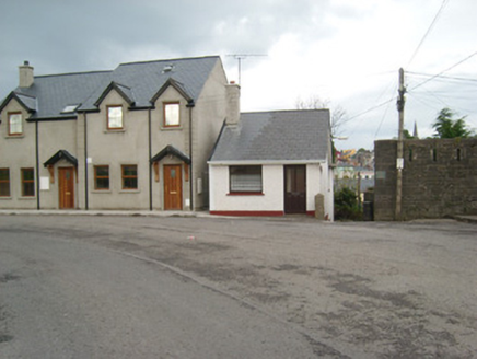
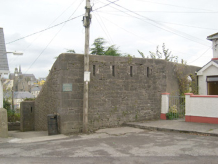
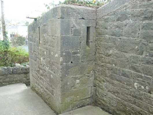
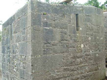
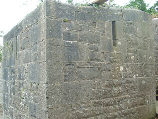
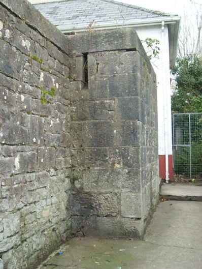
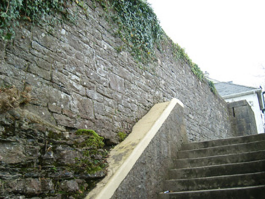
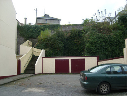
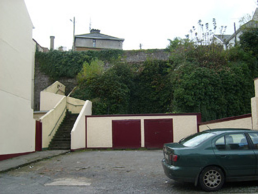
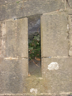
Sections of boundary wall on irregular-plan surrounding site of former Rock Barracks, erected c. 1798. Barracks now demolished, formerly on D-shaped plan extending to the south of the present sites. Constructed of roughly squared and coursed limestone with chamfered dressed limestone coping over, and having flush dressed limestone bloc-and-start quoins to the corners. Square-headed gun loops with dressed limestone surrounds and having splayed openings to the inner side located at strategic locations along length of walls, particularly close to corners and defending flight of steps to the north, west and east sides. Located in an elevated location on a rocky outcrop overlooking Ballyshannon town and Ballyshannon Bridge from the south. Modern housing estate located to the south-east and south-west, built c. 1936. Concrete steps with rendered boundary walls to the west and north of site leading down to West Port Road.
Appraisal
These sections of boundary walls are all the remains of the former Rock Barracks. It is robustly-built in good quality masonry while the gun loops at intervals along the length, particularly defending corners, are indicative of its original use. It was originally built on a D-shape plan (flat to the north with walls on canted plan to the south having towers to the corners – Ordnance Survey twenty-five inch map), extending to the south of the surviving sections. This barracks was originally constructed in 1798 to further fortify and protect the important bridge and river crossing at Ballyshannon from possible French invasion and/or Irish rebellions. It occupied a commanding an elevated site on a rocky outcrop, and was built to defend the high ground to the south of the bridge while the earlier infantry barracks (40852063) defended the north side of the bridge. It appears to have been originally in use as a cavalry barracks (Ordnance Survey first edition six-inch map 1836) but was later in use as an infantry barracks (Ordnance Survey twenty-five inch map c. 1906). The barracks building later appears to have been used as a temporary prison during the Irish Civil War in 1922 -3 (Dáil Questions records). It remained in use until May 1925 when it was handed over by the Irish Army to Donegal County Council, who subsequently demolished the barrack buildings and built houses on the south part of the site c. 1936. Apparently much of the stone from the Rock Barracks was later use to clad the new bridge over the River Erne (40852064) in 1946-7. A Thomas Weir may have been the barrack sergeant here in 1846, a Joseph McDermott in 1881 was barrack sergeant and a Thomas Kincaid served in the role in 1894 (all Slater’s Directory). These simple boundary walls are an important if subtle element of the built heritage and social history of Ballyshannon, making a positive contribution to the streetscape to the south part of the town