


Survey Data
Reg No
40904012
Rating
Regional
Categories of Special Interest
Architectural
Original Use
Beacon
In Use As
Beacon
Date
1790 - 1830
Coordinates
168230, 416228
Date Recorded
06/09/2016
Date Updated
--/--/--
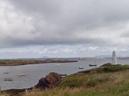
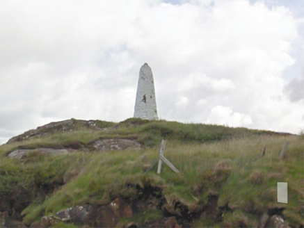
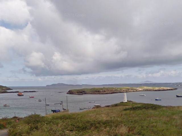
Description
Freestanding navigation beacon on tapering round plan, erected c.1810. Constructed of rubble stone masonry with remains of lighting beacon(?) to head. Painted white. Located a short distance north of the navigation channel linking An Leadbh Gharbh [Leabgarrow] on Árainn Mhór [Aran Island] with Ailt an Chorráin [Burtonport] on the mainland.
Appraisal
This simple but conspicuous and well-built feature forms part of the extensive and interesting maritime heritage of Dún na nGall [County Donegal]. It is robustly constructed using local rubble masonry and is painted white to make more visible when approaching the main landing place on Árainn Mhór [Aran Island]. Its date is uncertain, but it was at the time of the Ordnance Survey edition of about 1837, being indicated as an 'obelisk', and was later indicated as Stackamore (Ordnance Survey edition of about 1906).