
Survey Data
Reg No
40905381
Rating
Regional
Categories of Special Interest
Architectural
Original Use
Walled garden
Date
1770 - 1830
Coordinates
222349, 415251
Date Recorded
15/11/2013
Date Updated
--/--/--
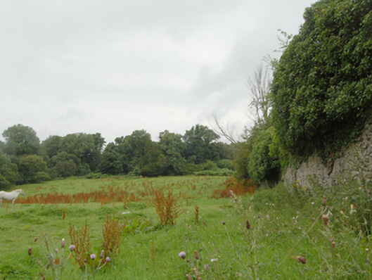
Description
Walled garden associated with Castle Wray (now ruinous, see 40905304) on rectangular-plan, erected c. 1790. Now partially in use as farmland. High rubble stone boundary walls with rubble stone coping over with modern cement repairs in places. Integral square-headed pedestrian entrance to the south-west corner with remains of battened timber door. Located to the north of the site of Castle Wray, and to the north-east of Letterkenny a short distance to the west of the shores of Lough Swilly. Remains of additional walled garden to the adjacent to the west (see 40905330). Remains of rubble stone outbuildings to the south-west. Single-arched rubble stone bridge (see 40905384) over stream to the south-west of walled garden.
Appraisal
This substantial former walled garden complex retains its early form and character, and now acts as an historical reminder of the Castle Wray (now ruinous, see 40905304), and the Wray family who built it. The simple but well-built boundary walls survive in relatively good condition with the unrefined rubble stone construction indicative of the original utilitarian uses. The scale of these walled gardens provides an interesting historical insight into the extensive resources required to run and maintain a large country estate in Ireland during the nineteenth-century, when they would have been used to produce a variety of foodstuffs for use in the main house and throughout the estate, and possibly also to provide an income source. There were formerly glass houses and other buildings to the west side of the garden, now demolished. Castle Wray was originally built by the Wray family, one of the most important family of landowners in the county during the seventeenth century into the nineteenth century. The Wrays acquired the site during Plantation times, c. 1610, and built the original house shortly afterwards, which was a house ‘of lime and stone within its protecting bawn’. This was replaced in the eighteenth century by a Georgian two-storey house on or near the same site. The house appears to have been extended around 1840 (Ordnance Survey maps). The house remained in the Wray family until c. 1820 when it passed into the ownership of the Mansfield family. It was the home of a Francis Mansfield in 1824 (Pigot's Directory), a Capt. Ralph Mansfield in 1846, and a Col. Francis Mansfield in 1881 and 1894 (all Slater’s Directory). The house was apparently unoccupied in the 1930s, and was subsequently demolished. Interestingly, this walled garden adjoins that of Castlegrove (see 40905330), an unusual feature. This walled garden is an addition to the built heritage of the local area, and is an interesting feature in the rural landscape to the north-east of Letterkenny. The simple stone bridge along the former path between the house and the walled garden adds to the setting.