


Survey Data
Reg No
40907914
Rating
National
Categories of Special Interest
Architectural, Historical, Technical
Original Use
Bridge
In Use As
Bridge
Date
1650 - 1720
Coordinates
229246, 394005
Date Recorded
03/06/2008
Date Updated
--/--/--
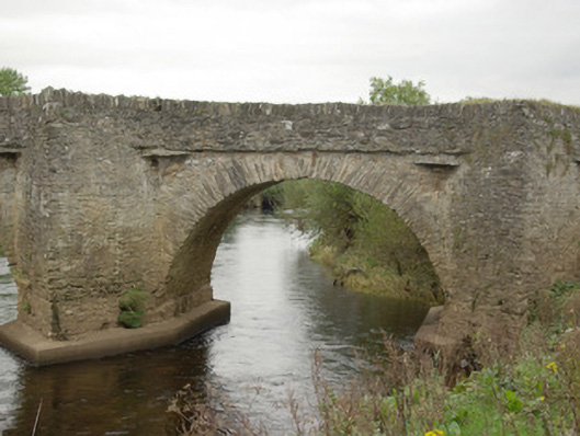
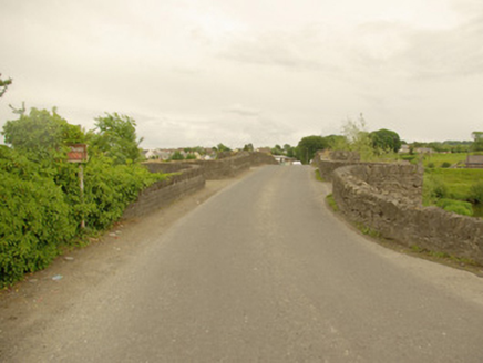
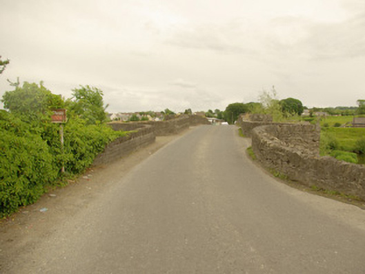
Description
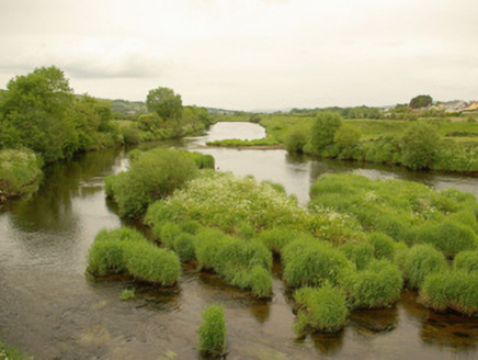
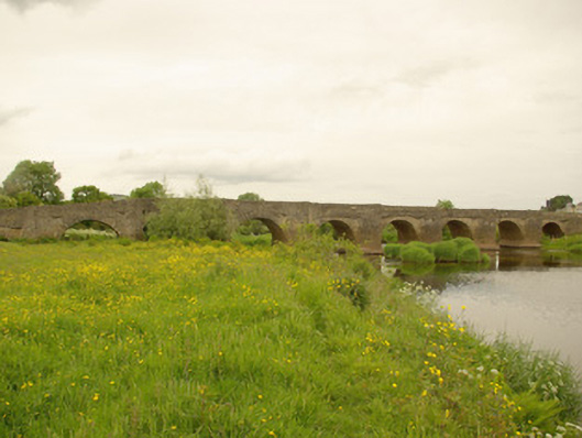
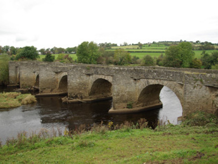
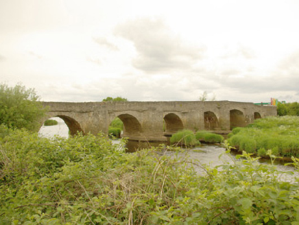
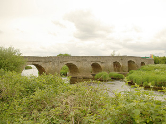
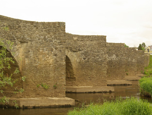
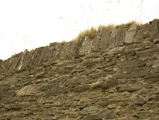
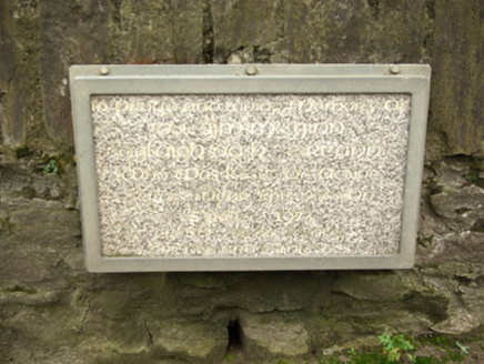
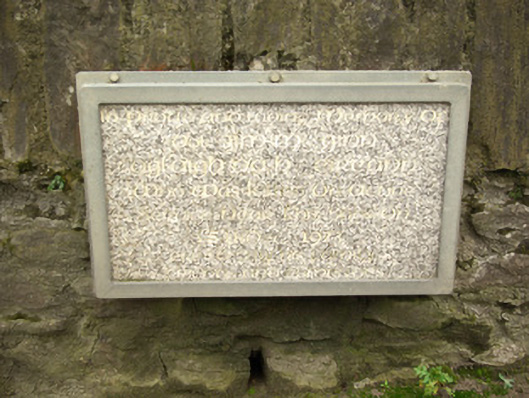
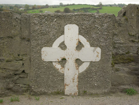
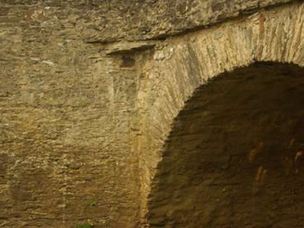
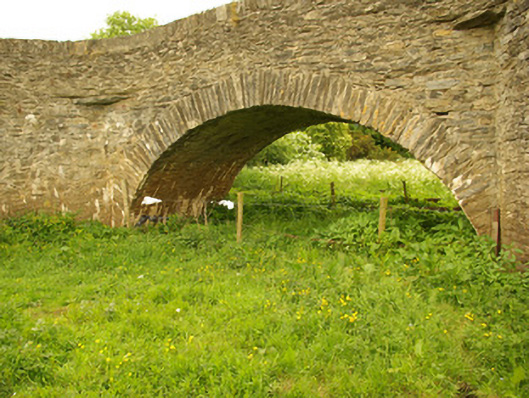
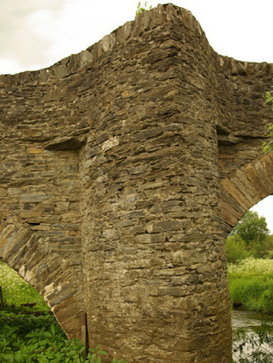
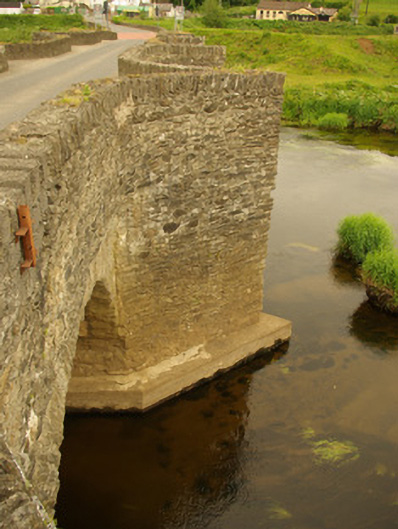
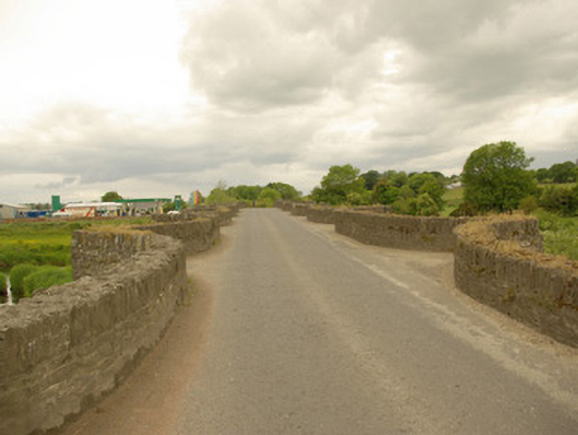
Nine-arch bridge carrying Urney Road over the River Finn, built c. 1680 and possibly containing earlier fabric, having seven arches over river and two dry flood arches to the west end, and with prominent V-profile rubble stone cutwaters to piers rising to form pedestrian refuges at road deck level. Partially remodelled in 1832 (three arches remodelled). Some modern repairs to parapets and modern reinforced concrete underpinning to arches. Round and segmental-headed arches having rubble stone voussoirs; rubble stone construction to arch barrels with recent cement lining over. Roughly coursed rubble stone construction to abutments, spandrels, piers and cutwaters. Rubble stone construction to parapets with rubble stone soldier coping; later ashlar\cut stone coping in sections and modern repairs in blockwork in places. Cut stone corbels to corners of pedestrian refuges supporting road deck. Two memorials to parapets, one with metal Celtic cross motif (undated) and one modern marble plaque commemorating death of IRA member on bridge in 1973. Tarmacadam deck. Parapet walls continues to form rubble stone boundary walls to surrounding fields to east and west. Located in the rural countryside to the east of Castlefinn. Bridge spans the border between County Donegal and County Tyrone, and subsequently the border with Northern Ireland. Cloghfin village to the west\north-west of bridge and Clady village to the east.
Appraisal
This important and majestic multiple-arch road bridge is one of the most impressive examples of its type surviving in Donegal, and indeed Ulster. This bridge is robustly-constructed in good quality squared local rubble stone masonry, and its continued survival and use stands as testament to the quality of its original construction, and of the skill of the masons involved. The massive full-height cutwaters to the piers rising to pedestrian refuges at parapets level, the unrefined rubble stone construction, and the narrow plan of the deck all suggest that this fine bridge of considerable antiquity, probably dating to the seventeenth century or to the very early eighteenth century at the latest. The form of this bridge is similar to a number of early bridges in Ireland including the probable sixteenth century bridges at Newtown and Kilcarn, County Meath, and at Lissenhall, County Dublin, although this bridge at Clady is probably later than these structures. Clady Bridge is indicated and named on Herman’s Map of Ireland dated 1714 so it was certainly in existence by this time. The central three arches were apparently modified in 1832 to allow for the passage of boats along the River Finn. This bridge crosses an historic fording point of the River Finn. According to local sources, in April 1650 the Catholic Army of the North, under the Bishop Heber McMahon, crossed the River Finn at a bridge at Cladyford, then the name of Clady, in pursuit of the Cromwell’s Parliamentary Army. Clady Bridge was apparently later the scene of two major battles during the Jacobite Wars (1688 – 91) in 1688 and again on the 15th of April 1689, immediately prior to the Siege of Derry (18th April 1689 to 28th July 1689). There are references to a ‘recently built bridge’ here that was crossed by the Duke of Berwick, illegitimate son of James II, with 300 men and 600 horses, following a battle with the Ulster Protestant Army under Colonel Skeffington. The Williamite forces apparently destroyed one of the arches on the County Tyrone side of the bridge in an attempt to slow the Jacobite forces as they made their way towards Derry. The Jacobite apparently placed timber boards over the collapsed arch, over which King James II and his army passed on their way to Derry. In more recent times the bridge was intended to be dynamited by the IRA during the Civil War in 1922, and plan that thankfully never came to fruition; and in 1973, an IRA volunteer, Jim McGinn, was killed here when bomb he was carrying exploded prematurely. A modern memorial plaque to one of the parapets commemorates this event in 1973. This fine and imposing bridge is one of the more important structures of its type in the north-west of Ireland, and is a valuable addition to both the built heritage and extensive transport heritage of County Donegal. This bridge spans the border with County Tyrone to the east and, subsequently, the border with North Ireland. It is apparently the only border crossing with traffic lights.