Survey Data
Reg No
40908906
Rating
Regional
Categories of Special Interest
Technical
Original Use
Quay/wharf
In Use As
Quay/wharf
Date
1780 - 1820
Coordinates
149315, 379977
Date Recorded
31/10/2007
Date Updated
--/--/--
Description
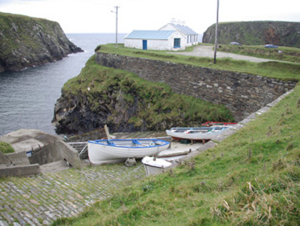
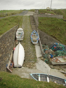
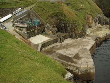
Slipway and quay on rectangular-plan, built c. 1850, built into the side of a cliff/cove. Still in use. Deck of slipway lined with granite setts; rubble stone retaining walls to adjacent hillsides. Five terraced levels drop from cliff top track to quay. Quay wall of squared random rock to east elevation, ashlar to north and west elevations. Modern concrete deck and steps to sea level, metal railings and ladders. Three flights of walled concrete steps from track to quay. Located to the south-west of Malin Beg at Ougue Port. Altered single-storey buildings and stores to the south-west.
Appraisal
Despite modern additions and multiple repairs, these quay walls and slipway retain much of their early character. They are robustly-built using local masonry, and their continued survival and use is testament to the quality of their original construction. These features may have been built by the Ballast Board/Board of Works to provide a shore base etc. for the construction and maintenance of the lighthouse and associated structures at nearby Rathlin O’Birne Island (see 40908904). These modest structures continue to provide an important local amenity, and are additions to the extensive maritime heritage of the local area.


