


Survey Data
Reg No
40909217
Rating
Regional
Categories of Special Interest
Architectural, Technical
Previous Name
Inver Railway Station
Original Use
Bridge
In Use As
Bridge
Date
1890 - 1900
Coordinates
182132, 378847
Date Recorded
11/11/2007
Date Updated
--/--/--
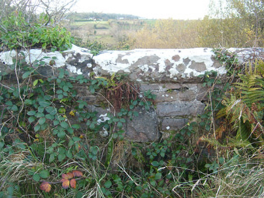
Description
Single-arch former railway bridge, built c. 1893, carrying road over the former Donegal Town to Killybegs narrow gauge railway line. Now out of use (since 1960) with railway line removed. Snecked and squared rock-faced stone construction to spandrels and to parapets with rock-faced coping over parapets. Squared rubble stone construction to arch barrel. Segmental-headed arch with rock-faced ashlar voussoirs having dressed margins. Tarmacadam deck with grass verges. Side elevations of bridge (east and west) now largely covered in vegetation. Located to the north of Inver and the north-west of Mountcharles. Former Inver railway station adjacent to the east (see 40909218) and former water tank adjacent to the west.
Appraisal
This impressive former railway bridge retains its original form and character despite the closure of the line in 1960. The good-quality rock-faced masonry used in its construction is typical of Victorian railway engineering and architecture in Ireland. It survives in excellent condition, which is testament to the quality of its original construction, and the skill of the masons involved. It was originally built by the Donegal Railway Company as part of the Donegal Town to Killybegs section of the Derry (Victoria Road) to Killybegs railway line, which opened in August 1893 and closed completely on January 1st 1960. This railway bridge forms part of a group of structures associated with this former narrow gauge railway line at Inver along with the former railway station adjacent to the east (see 40909218) and the former water tank adjacent to the west, and is an integral t element of the built heritage and transport history of County Donegal.