
Survey Data
Reg No
41400702
Rating
Regional
Categories of Special Interest
Architectural, Technical
Original Use
Bridge
In Use As
Bridge
Date
1760 - 1780
Coordinates
270536, 342368
Date Recorded
12/04/2012
Date Updated
--/--/--
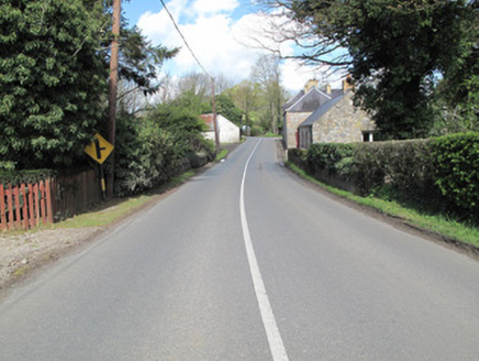
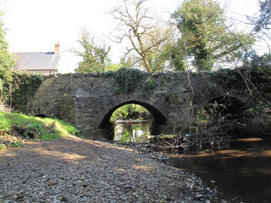
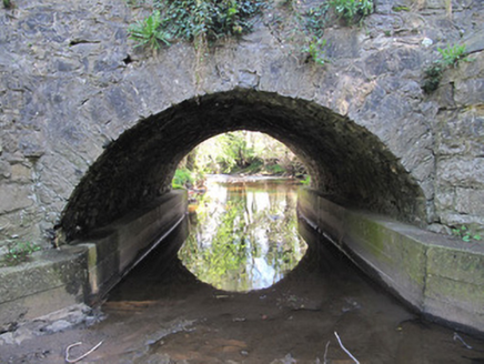
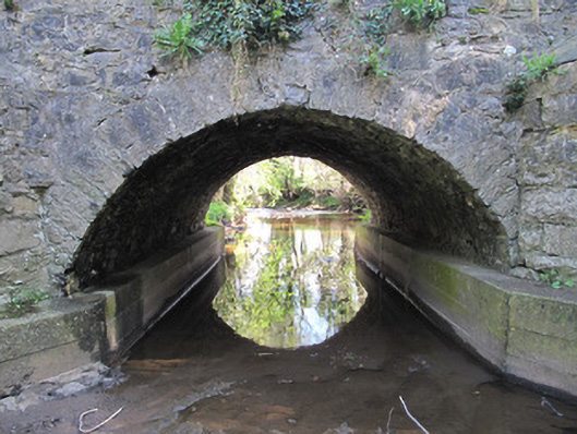
Description
Triple-arch bridge, built c.1770, carrying road over Mountain Water. Arch to north-west is flood arch, lower and currently dry. Segmental arches with roughly dressed limestone voussoirs and V-shaped cut-waters to each elevation having later concrete reinforcements and render capping. Coursed rubble limestone to spandrel and parapet walls, stone coping to parapets. U-shaped buttress to south-west elevation.
Appraisal
This bridge evokes a sense of the quality of local craftsmanship in the late eighteenth century. The size of its arches are indicative of its relatively early date, and their close spacing and the flat surface of the carriageway gives it a strong horizontal emphasis helping to visually connect both sides of the hamlet. The bridge illustrates the innovative engineering developments of this period. The dry arch was probably designed as a flood relief feature, and the pointed cut-waters would help deflect debris from the bridge piers in times of severe flood, while the presence of cut-waters on both elevations serves to illustrate an interest in architectural symmetry and balance in its design.