

Survey Data
Reg No
41401304
Rating
Regional
Categories of Special Interest
Architectural, Scientific, Technical
Original Use
Bridge
In Use As
Bridge
Date
1835 - 1840
Coordinates
261022, 330856
Date Recorded
22/04/2012
Date Updated
--/--/--
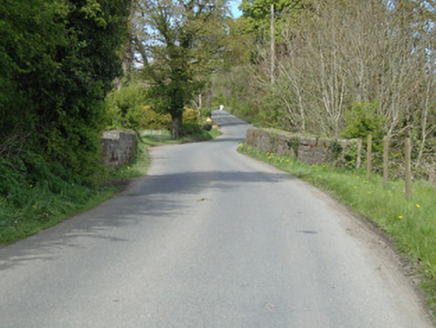
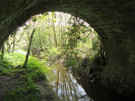
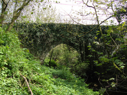
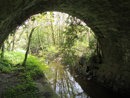
Description
Single-arch canal bridge, constructed c.1837, carrying road over now disused Ulster Canal. Coursed squared snecked limestone rubble walls to parapet, much of west parapet rebuilt in concrete blockwork. Segmental arch with dressed stone voussoirs and intrados, random rubble spandrels, and with string course to arch crown. Steep earthen ramped incline from canal to road level. Squared random rubble abutments, part of west face of south abutment replaced with concrete blockwork. Towpath platform running along north abutment underneath arch.
Appraisal
Drumsnat Bridge is a fine example of the canal bridges of the Ulster Canal, a disused waterway running through counties Armagh, Monaghan, Tyrone and Fermanagh from Lough Neagh to Lough Erne. The bridge remains in use for a local road. High-quality stone masonry with crisp joints and snecked intersects is displayed in the structure, while squared rubble walling makes an interesting and pleasing textural contrast to other, more formal, canal bridges in the area. The bridge is a reminder of the canal network development in Ireland. The Ulster Canal was built between 1825 and 1842 and was 74km (46mi) long, this section of the canal opening between 1838 and 1841. Its 26 locks were built narrower than the other Irish waterways, preventing through trade, and the system had an inadequate water supply from its very establishment. The canal fell into rapid decline from the mid-nineteenth century and was abandoned in 1931.