

Survey Data
Reg No
41401910
Rating
Regional
Categories of Special Interest
Architectural
Previous Name
The Castle
Original Use
Walled garden
Date
1830 - 1850
Coordinates
273184, 320066
Date Recorded
20/05/2012
Date Updated
--/--/--
Description
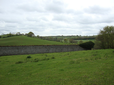
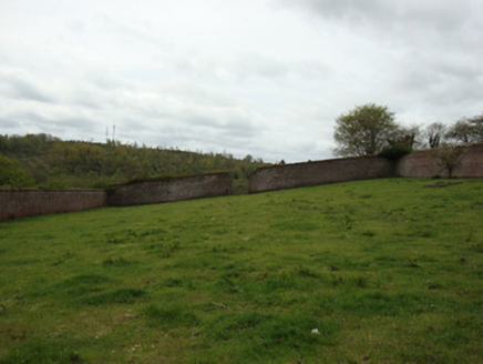
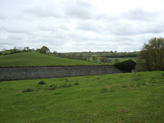
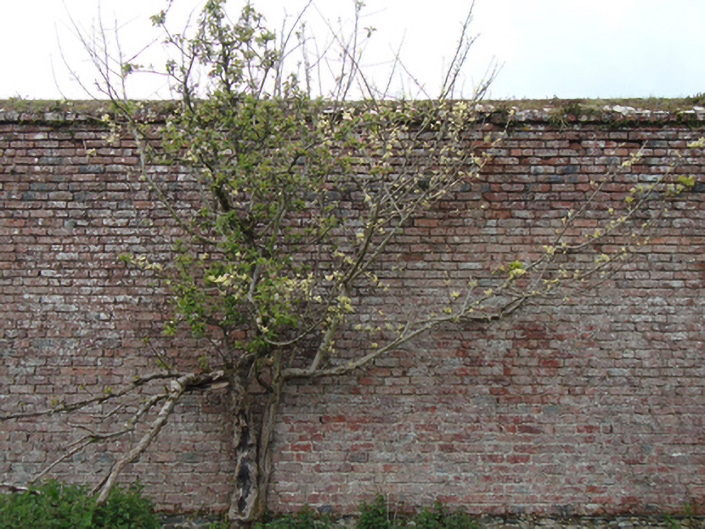
Rectangular-plan walled garden, built c.1840, now disused. Coursed rubble limestone walls to exterior, having red brick header-bond copings. Red brick lining in double Flemish garden wall bond to interior walls. Gauged-brick square-headed door opening to centre of west elevation, with block-and-start red brick surround. Gauged-brick segmental-headed door opening to centre of east elevation. Evidence of segmental arch to centre of north wall, now blocked up. Full-height break to middle of south wall. Small lean-to structure to interior of east elevation, with cement rendered walls, cast-iron rainwater goods, corrugated-iron roof, and square-headed openings. Five-bay two-storey farmhouse to north-west, still in residential use. Lean-to former stable buildings to north of walled garden. Ruins of former chicken house to west of walled garden with coursed rubble limestone walls having cut-stone quoins, brick surrounds to door openings, and corrugated-iron roof. Cast-iron gate piers to south-west identify entrance to former burial ground. Concrete plinth to south-west said to be former bell tower.
Appraisal
This substantial walled garden forms an important historical group with the adjacent outbuildings of Ballybay House. The latter house itself was destroyed in the early twentieth century. The Ballybay Estate was part of the Leslie Estate, and Ballybay House was constructed about 1820 overlooking Lough Major. The Leslies had a strong influence on the development of the planned town of Ballybay as absentee landlords, constructing the market house in 1848. Ballybay House was destroyed by fire in 1921, at which time these walled gardens, and associated outbuildings were sold. The 1908 OS map depicts Ballybay House with grid-like walled gardens, outbuildings and family burial ground on 'Bell Hill' to the south-west. This formalisation of the landscape, so iconic of demesnes in Ireland and Britain, was primarily the result of the erection of walled gardens. They were an integral part of the demesne landscape, providing a sheltered environment, often faced with brick for heat retention, allowing the cultivation of a wide variety of kitchen ingredients for the house as well as a formal walk for residents. Although it is no longer in use as a walled garden, the structure and original materials are completely intact apart from a small opening in the wall to the south.