
Survey Data
Reg No
41402201
Rating
Regional
Categories of Special Interest
Architectural, Scientific, Technical
Original Use
Bridge
In Use As
Bridge
Date
1780 - 1820
Coordinates
252134, 317223
Date Recorded
16/04/2012
Date Updated
--/--/--
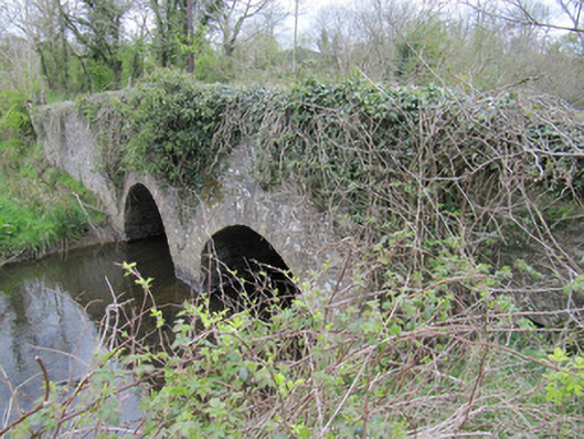
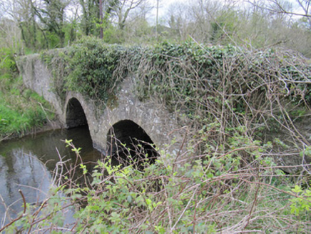
Description
Two-arch rubble limestone bridge, built c.1800, carrying road over Bunnoe River. Rubble stone walls and parapet walls. Round arches with dressed voussoirs, cut-stone V-cutwater to north face. Rubble stone soffits with some remaining render.
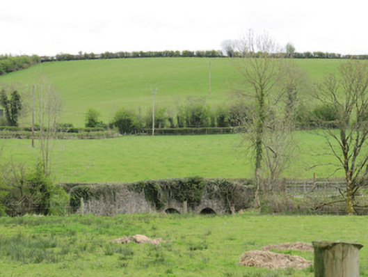
Appraisal
This is a well constructed bridge still in use today, indicating skilled engineering and execution. The use of local materials, small arches, and rubble stone is typical of early bridges on local roads, and it would have been important for the nearby creamery and mill in the past. It makes a pleasing feature in the landscape, glimpsed from nearby roads. Of social interest locally as it demarcates the boundary between two townlands.