Survey Data
Reg No
50010456
Rating
Regional
Categories of Special Interest
Architectural
Previous Name
Jervis Street Charitable Infirmary
Original Use
House
In Use As
Shop/retail outlet
Date
1720 - 1740
Coordinates
315496, 234519
Date Recorded
07/12/2011
Date Updated
--/--/--
Description
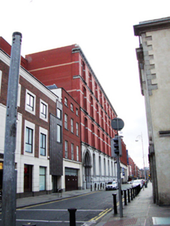
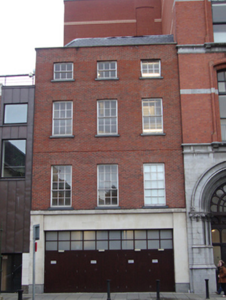
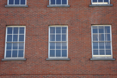
Attached three-bay four-storey house, built c.1730, over concealed basement, now in use as part of Jervis Shopping Centre. L-shaped slate roof, hipped to north and west, hidden behind red brick parapet wall. Red brick walls laid in facer bond, having band of replacement brick to third floor, string course with raked mortar to first floor and granite coping to parapet. Concrete platband over modern porcelain-clad ground floor, having four timber fire escape doors. Gauged-brick square-headed window openings to upper floors, having exposed reveals and replacement granite-clad sills. Timber sliding sash windows, three-over-three pane to third floor, one replacement timber casement window to same floor, six-over-six pane sash to second floor and nine-over-six pane to first floor. Rendered and painted wall to third storey of north elevation. Concrete paved path to west elevation having fluted cast-iron bollards and concrete kerbstones.
Appraisal
Jervis Street was once occupied by late seventeenth-century and early eighteenth-century gabled houses of which this is one of the very few remaining. The unusual facer bond brick, which does not allow for ties between the inner and outer leaves of the wall, indicates a relatively early date while the diminishing window opes and sash windows clearly indicate the structure's Georgian beginnings. This house is shown in a photo of Jervis Street Charitable Infirmary taken c.1890, as having a double-pitched roof and chimneystack to north, balconnettes to first floor windows, and a round-headed eighteenth-century doorway surround with a fanlight. The house was originally part of a terrace with three-storey houses running northwards to the corner of Mary Street, all facing Saint Mary's Church and graveyard. Jervis Street Hospital to the south, was built on the site of the eighteenth-century mansion of the Earl of Charlemont (No.14 Jervis Street). The Jervis Street hospital of 1886 dwarfed the house, and the current Jervis Centre to the east, constructed c.1995, does likewise. Only the facade of this house and the hospital were retained and this former house now houses a fire exit for the Jervis shopping centre. Jervis Street was named after Humphrey Jervis (1630-1707), Lord Mayor of Dublin in 1681-3, who laid out the area around Saint Mary's Abbey after buying much of this estate in 1674. Jervis developed a network of streets arranged in a nine-square grid, including Jervis Street, Stafford Street (now Wolfe Tone Street), and Capel Street, as well as building Essex Bridge.


